History of the Tree of Science
The Tree of Science Monument is the monument located at the Eskişehir Yolu gate (A1 Entrance) of the main campus of the Middle East Technical University in Ankara. The project, which came second in the Atatürk and His Revolution Monument Competition, which was opened to be placed on the campus in 1965, was made in 1966 by Sculptor Tamer Başoğlu and Architect and City Planner Ersen Gürsel.
The work of Şadi Çalık, who came first in the competition, is applied in the place called “Physics Grass” in front of the Physics Department. The Rectorate also considers exhibiting the second-placed project in a suitable place on the campus. The proposed monument is redesigned to be applied to the area next to the main gate of the METU Campus on Eskişehir Road. Known as the Science Tree, the work is a symbol of METU today.
This monument is the first sculpture in Turkey to describe Atatürk and his revolutions abstractly. In this sculpture, Atatürk and his revolutions, reminiscent of the explosion of an atomic bomb in the form of a mushroom on a dynamic and strong root in a ruined and devastated Anatolian city, were intended to be explained. Each end on the statue symbolizes Atatürk’s revolutions.
—Tamer Başoğlu
Rector Kemal Kurdaş suggested that the monument should be named “Tree of Science” since he explained that METU was a science tree in the modern sense and that a new mentality had started in Turkey. At the same time, the statue was being placed, and the monument has been known as the “Tree of Science” ever since.
Modeling Tree of Science using SiteEye
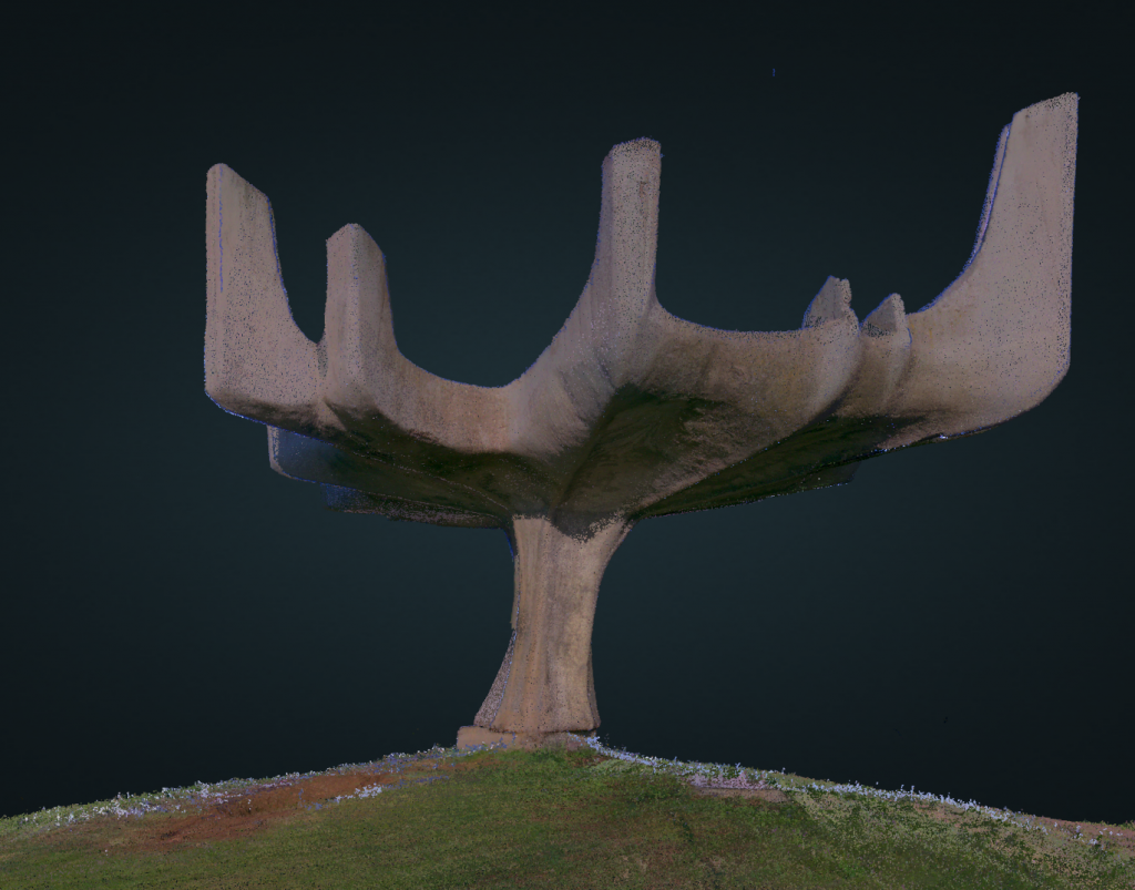
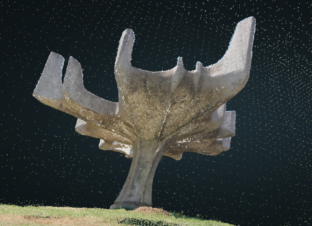
A 3-dimensional model of the work was created by using unmanned aerial vehicle (drone) and terrestrial laser scanning shots by the SiteEye flight team. You can view the 3D models of both by signing up SiteEye for free
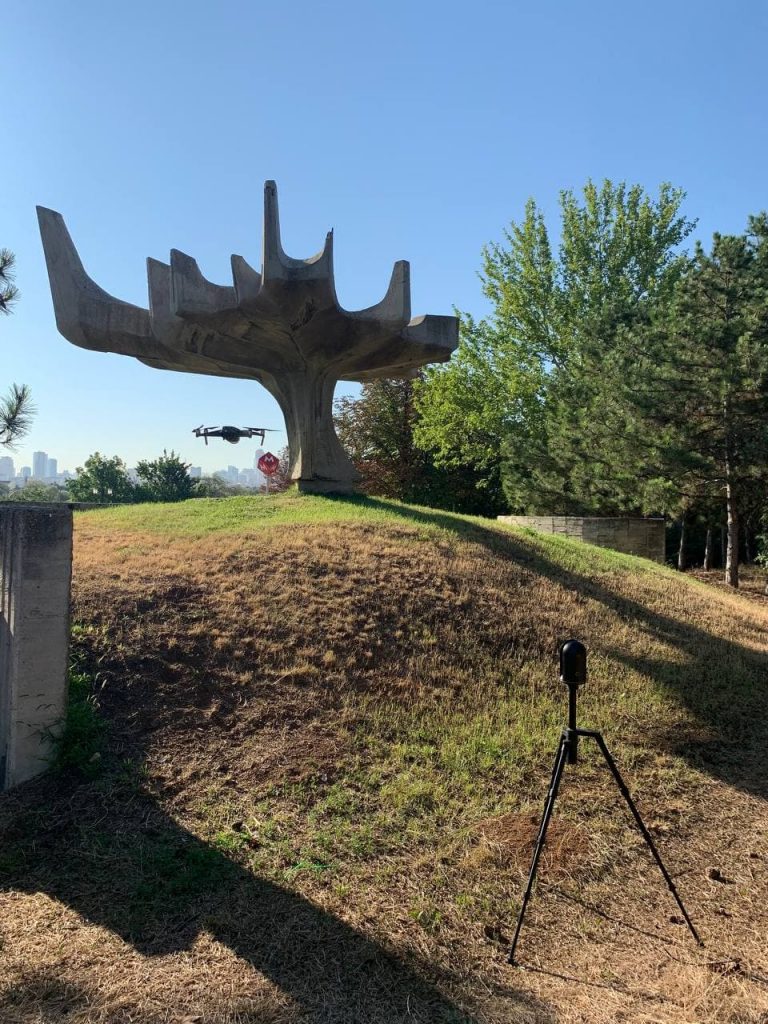
Modeling with Drones
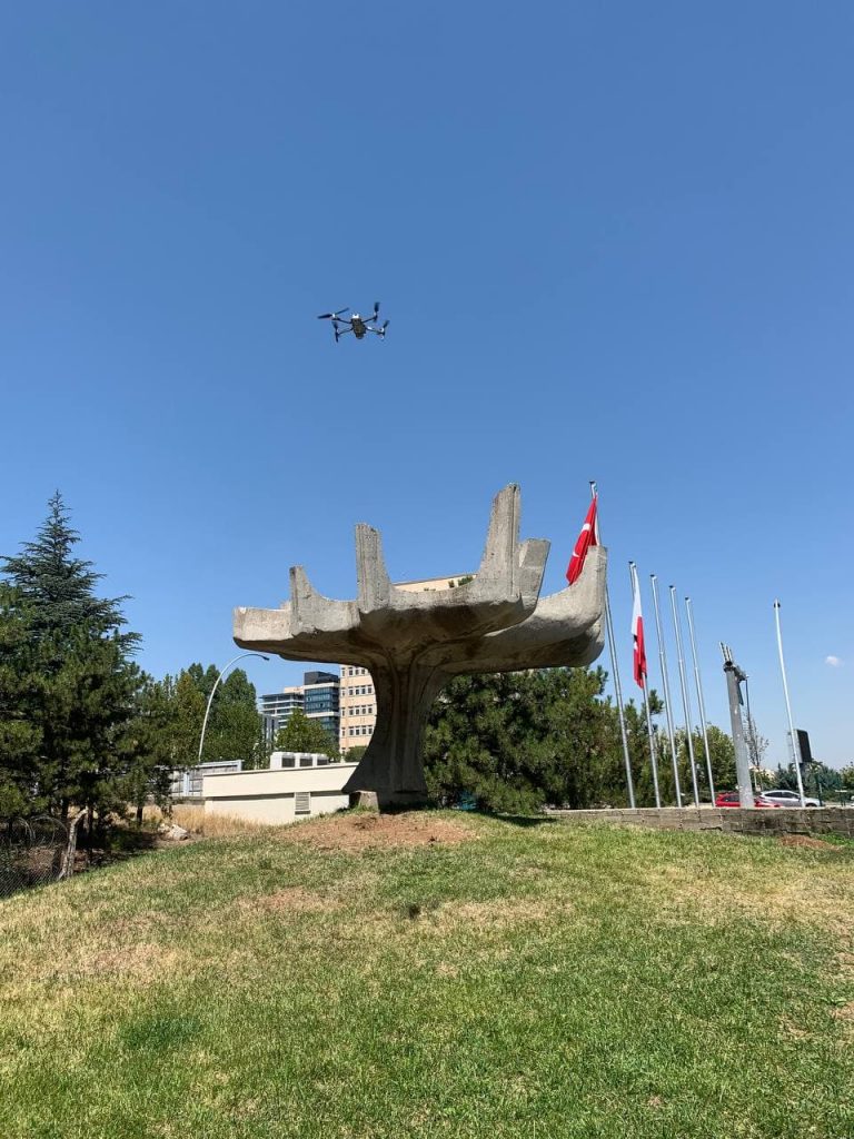
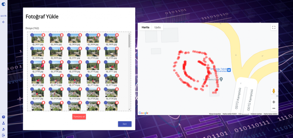
In order to model with the UAV, overlapping photographs were taken with the 360-degree drone from its surroundings, within the photogrammetric modeling principles. The photographs were uploaded to the cloud storage area via the SiteEye modeling interface, screenshot of which is given below, and the analysis was started by selecting the photogrammetric analysis “Intermediate” model quality.
DJI 2 Mavic Pro drone model was used for image acquisition. Image acquisition took about 15 minutes, and uploading to the system and creating analysis took about 1.5 hours. The 3D modeling process with the UAV was completed in a total of 2 hours. With faster internet and SiteEye advanced membership packages, the model building process can be shortened even more.
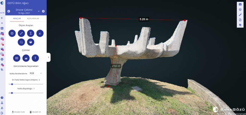
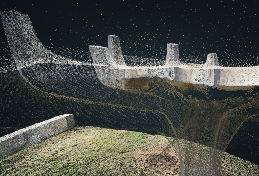
With the SiteEye web interface, it is possible to make geometric measurements such as length, height, area and slope on the 3D point cloud with a ground sampling distance of 1.531 cm.
Yer örnekleme mesafesi (ground sampling distance) 1.531 cm olan 3D nokta bulutu üzerinde SahaGözü web arayüzü ile uzunluk, yükseklik, alan, eğim gibi geometrik ölçümler yapmak mümkündür.
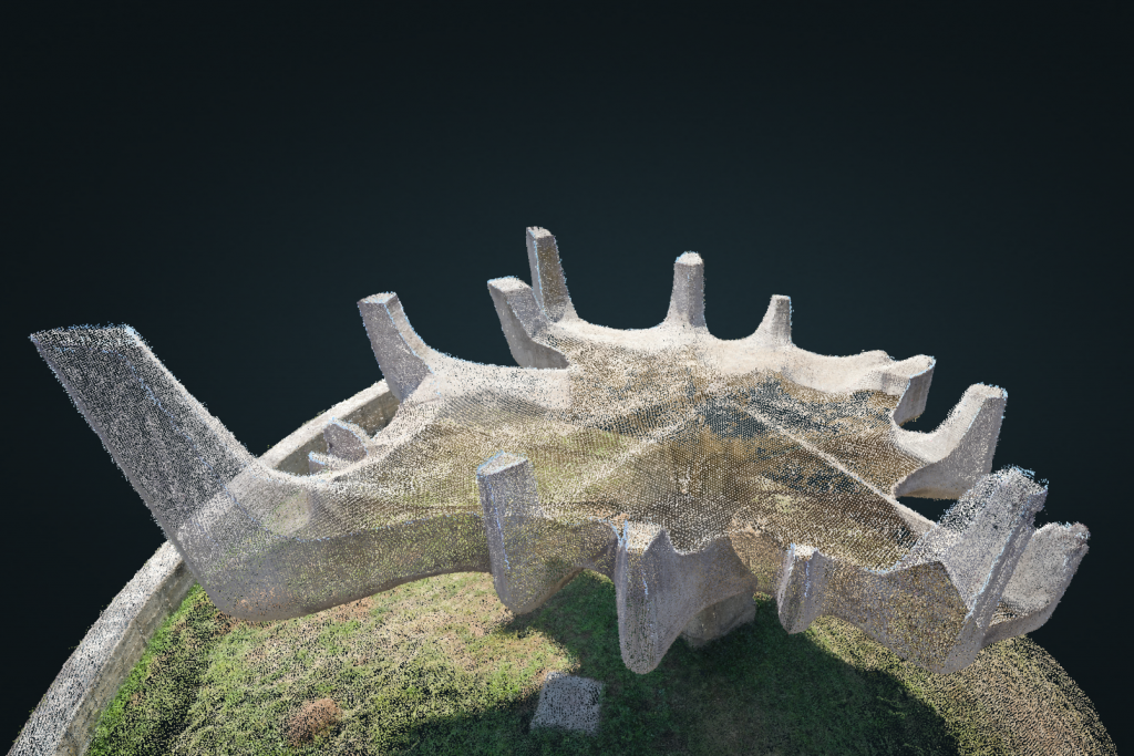
Modeling with Terrestrial Laser Scanner
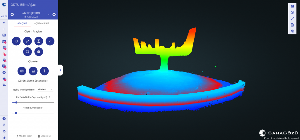
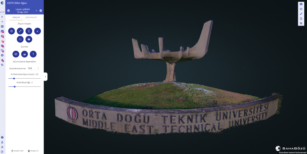
11 ground stations are planned to be able to see the Science Tree in a way that there is no missing angle for modeling with a laser scanner. The laser scanner is tuned so that each station setup collects a “High” density point cloud. Leica BLK360 scanner model was used as laser scanning device.
The data collection process took approximately 1.5 hours. Then, the obtained part point clouds were combined with the software of the laser scanning device and uploaded to SiteEye using the point cloud upload interface you see below. Modeling with a laser scanner, along with point cloud merging and noise removal processes, took approximately 4 hours.

The same geometric measurement capabilities of SiteEye can be used on point clouds loaded by UAV modeling and laser scanning. The point cloud can be displayed by RGB and digital height.
